16 The Hydroclimatic Atlas of Southern Québec1
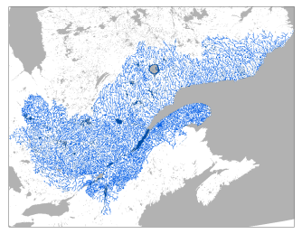
The Hydroclimatic Atlas of Southern Québec, developed by Quebec’s Ministère de l’Environnement, de la Lutte contre les changements climatiques, de la Faune et des Parcs (MELCCFP), describes the water regimes of rivers in current and future climates. The most recent version, which was put online in 2022, provides access to historical river flow data from 307 hydrometric stations located in the southern part of Quebec (Figure 16.1).
It allows the public to explore the hydrological future of southern Quebec’s watersheds in the context of climate change. Simulations from several climate models were used as input data for a hydrological model. A total of 76 hydrological indicators on high water levels, low water levels and average seasonal and annual flows were simulated for sections of the watersheds of southern Quebec.
The hydrological indicators are evaluated for four 30-year periods. One is the past climate, 1981–2010, which is used as a reference period, and three are future climates: 2011–2040, 2041–2070 and 2071–2100. The indicators’ variations between reference periods and future periods are also estimated in accordance with two greenhouse gas emission scenarios.
A level of confidence in the overall conclusions drawn from these analyses is assigned, based on an expert opinion. A high level of confidence is assigned when the key processes involved are thought to be modelled well. A moderate confidence level is assigned when the large-scale conclusions might be different at local scales or improved modelling could lead to slightly different results. However, these conclusions are solid and useful enough to be disseminated and used in climate change adaptation.
The main conclusions regarding flood indicators are as follows2: (1) spring freshets will be earlier [high confidence]; (2) spring freshet peak flows in northern watersheds will increase [moderate confidence]; (3) spring freshet peak flows in southern watersheds will decrease for 2- and 5-year recurrences and increase for 100-year and greater recurrences [moderate confidence]; (4) summer-fall peak flows will increase [moderate confidence]; and (5) spring freshet volumes will decrease in southern watersheds [moderate confidence].